Georgia Avenue Community Mapping
In July-August 2014, I helped organize a project teaching young people how to map on OpenStreetMap, the free and open map of the world, as part of a youth entrepreneurship project. With members of MappingDC, the DC OpenStreetMap group, we trained about 20 students ages 12-18 in Washington, DC to map out Georgia Avenue, a major commercial corridor in a largely lower-income part of town.
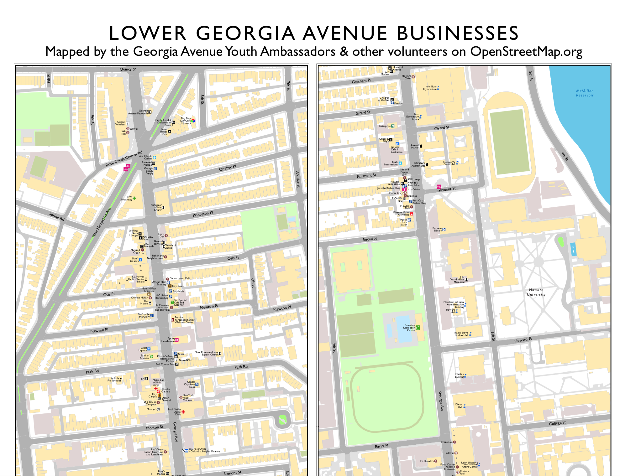
The idea was to collect data on businesses so local groups and citizens can use it, while at the same time teaching the kids new skills and getting them engaged in their community while seeing it from a new viewpoint through geography and mapping. By the end, the students added almost 300 businesses to OpenStreetMap along the street and learned about geography and mapping.
I created this poster-size map so the students could see everything they mapped, and also for the use of local businesses and organizations.
To read more about the project, go here.
<--- back to main page