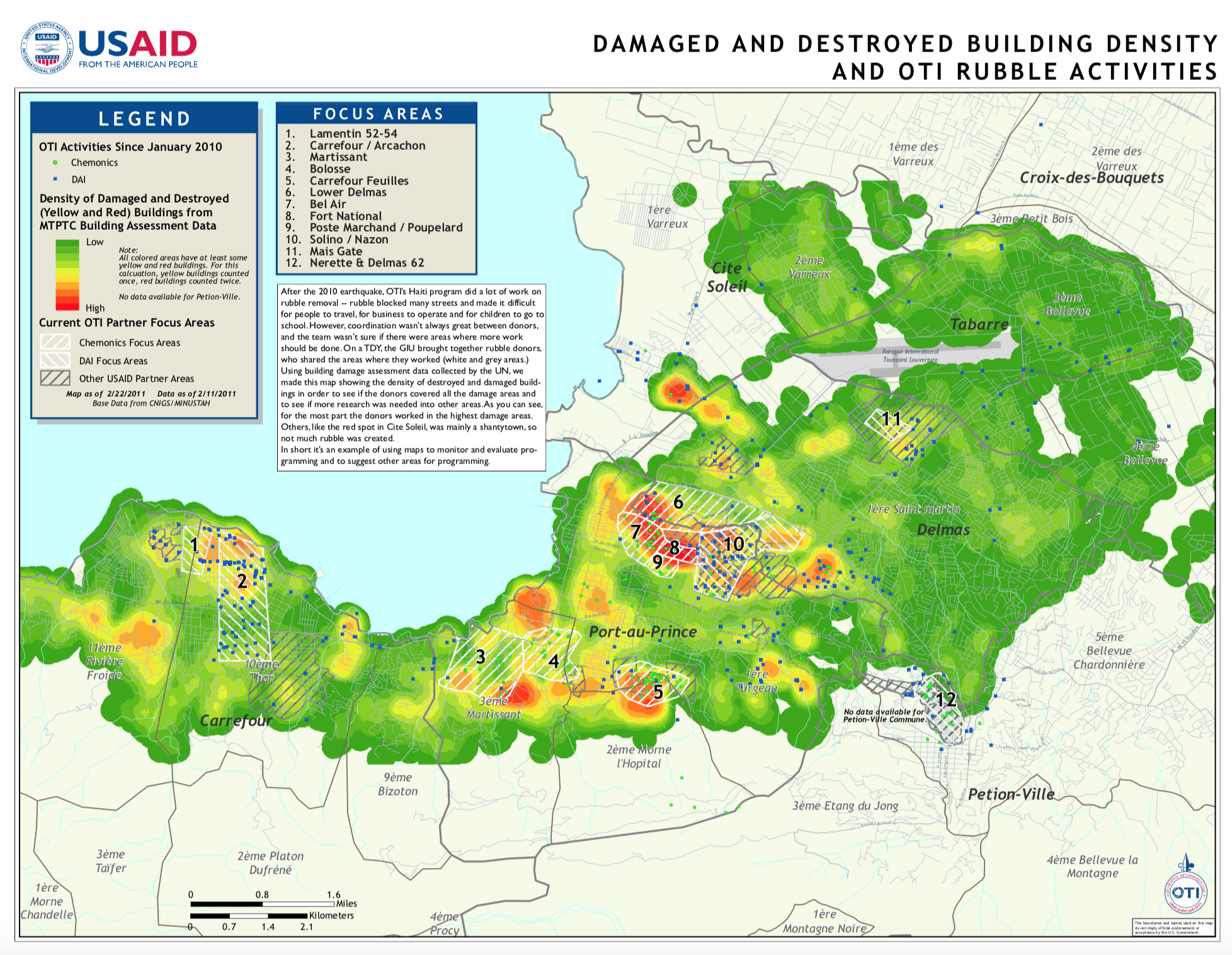
Damaged Building Density after the 2010 Haiti Earthquake
My office at the US Agency for International Development responded to the devastating 2010 earthquake, doing a number of projects to help people in the affected areas. One of the biggest was around rubble removal: thousands of structures in and around Port-au-Prince collapsed due to the shaking and shoddy construction materials and techniques. The rubble generated blocked roads and made it hard for people to go about their daily lives.
A number of different groups were doing rubble removal activities, and I created this poster-size map as a way to coordinate them -- I gathered whatever data (or lack thereof) that other groups had about their projects and added my office's work. I overlaid this data with a raster I created of the density of damaged and destroyed buidings as a proxy for rubble density. That data was created by a massive, door-to-door survey organized by the United Nations.
We used the map at a meeting of all the rubble partners to make sure there were projects in the right areas. The map also served to highlight gaps in the rubble programming.
<--- back to main page